
Pleasant Hill Neighbors Source Map
A block lookup works when each source is assigned a narrow purpose. CCMAP supplies the shape of the block. The assessment roll is the route to a named owner and mailing address, subject to counter access and protected entries. The Recorder holds deeds, maps, liens, and CC&Rs. California's voter file is restricted, and the ordinary status form is a self-check rather than a public block browse. Neighborhood Watch and private associations can provide contact paths without publishing a member roster.
| Source | What It Shows About a Block | Access |
|---|---|---|
| CCMAP | Parcel geometry, adjacent APNs, characteristics, aerials, contours, and radius context | Free county map viewer; no owner names online |
| Assessment roll | Owner of record, mailing address, and assessed information for a defined parcel | Assessor counter or request channel; protected entries apply |
| Recorder index | Deeds, maps, liens, CC&Rs, parties, dates, and legal descriptions | Online index, Old Book, counter, and copy routes |
| Approved voter file | Eligible address, precinct, and voter fields for a certified purpose | Restricted under California Elections Code section 2194 |
| Neighborhood Watch | Group existence, coordinator contact, and prevention resources | Ask the coordinator; no public member roster |
| HOA or CC&R records | Association name, recorded rules, agent, and subdivision connection | Recorder documents or Secretary of State entity search |
| Pleasant Hill district lookup | City Council district and representative for an address | City address search and five-district map |
The table describes block evidence, not a promise of names. A parcel owner can be an LLC, trust, or nonoccupant. A complex parcel can represent many units. An address can have a protected resident whose public record is suppressed. The immediate block is therefore a spatial result first and a person result only where a custodian lawfully supplies a separate clue.
Map a Pleasant Hill Neighbor Block
Start with the exact address, then confirm the APN before moving outward. The county's map and parcel systems are built for selecting land, not for naming every person in a radius. A clean note of the subject APN and nearby APNs makes the later assessment or Recorder request precise.
- Normalize the street number, direction, street name, unit, and ZIP, then establish whether the address is in Pleasant Hill.
- Search the address or APN in CCMAP and click the subject polygon until the parcel boundary and characteristics appear.
- Pan along the boundary or use radius selection, click each touching or nearby polygon, and record every APN without guessing a person.
- Use the Assessor's counter or request channel for owner and mailing information, then compare that clue with the Recorder's legal description.
- Stop at the documented parcel relationship. A full named-street chain belongs in the Pleasant Hill street directory, not in a block-radius shortcut.
The process turns one address into a small, checkable set of parcels. It also prevents a map click from being mistaken for proof that a person lives in a particular home.
Note: A radius tool selects nearby parcels, not the people who occupy them today or a confirmed household list.
CCMAP Shows Pleasant Hill Neighbor Parcels
CCMAP is the practical first stop for adjacent-parcel research. The viewer can display parcel boundaries and characteristics, aerial imagery, contours, downloadable assessor-map context, and a radius selection tool. It can help distinguish a side lot, a rear parcel, a corner parcel, or a larger complex from the street label that first brought a researcher to the area.
Three terms matter. An APN is the county parcel identifier. A parcel is a mapped unit of land for assessment and record linkage. A radius is a distance or map selection around a point, not a list of people who live within that distance. CCMAP's owner-name gap is deliberate: the county's public web tools omit every owner name because selective suppression of protected officials would be costly to maintain at web scale.
- Adjacent parcel
- A mapped parcel that touches or lies next to the subject polygon. It does not prove a household relationship.
- APN
- The assessor's parcel number used to connect a map, assessment entry, and recorded legal description.
- Radius selection
- A spatial tool for choosing nearby map features. It is not an owner-name or occupant search.
- Legal description
- The lot, block, subdivision, or metes-and-bounds wording that can outlast a street-number change.
Pleasant Hill Neighbor Radius Route
When clicking every parcel is too slow or the map view is hard to interpret, the Assessor publishes a staffed radius-search alternative for $50. That route can be useful when the request needs a defined distance around one parcel and a staff member's help. It is not a free ZIP-wide directory, and the result still needs the same care about owner versus occupant.
Other published Assessor prices show the same channel split: property-information printouts are $1 per page, and property characteristics are $7.50 per parcel. Online parcel facts are free, but the missing owner name is not a search error. A precise request should give the address, APN if known, radius or surrounding streets, and the record purpose allowed by the custodian.
Note: A paid radius result identifies a spatial set of parcels; it does not turn the set into a verified resident list.
Pleasant Hill Neighbor Owner Records
The assessment roll can name an owner of record and a mailing address, but it does not certify current occupancy. A mailing address different from the situs can suggest that tax correspondence goes elsewhere. Matching addresses may suggest owner occupancy, yet neither pattern proves who is inside the home today. Deeds show named parties and legal interests, not a live household count.
The Recorder's Official Records Index can test a parcel-linked name through deeds, reconveyances, liens, maps, and other instruments. A deed chain is a title trail. It is not a roster of people who sleep on a block. A trust or company name may be the recorded owner, while an occupant may never appear in a deed. Apartment records usually identify the complex parcel owner rather than each unit's occupants.
That distinction is central to a responsible Pleasant Hill block lookup. The strongest public conclusion may be “these parcels touch” or “this entity is named in a recorded instrument.” A stronger residential conclusion requires a separate, lawful source and a date that fits the question.
Pleasant Hill Apartment Neighbor Limits
A multi-unit parcel creates a hard boundary for public block research. CCMAP can show the complex footprint and APN. The assessment roll can identify the parcel owner and mailing address. A permit or code file can identify a project, applicant, contractor, or address. None of those sources publishes a unit-by-unit resident list, and a complex owner's mailing address is not the address of every person who lives there.
Private association material can add only what the association chooses to share. CC&Rs can identify a subdivision, rules, or recorded association language. Member lists, unit rosters, contact details, and internal notices are generally private. A block search should not fill that gap by treating a parcel name as every household or by inferring unit occupants from a business or delivery record.
For safety awareness, use a building manager or a public community contact only when the person or organization offers one. Do not ask a neighbor to reveal a private roster. The spatial relationship is enough to guide a public-record request without exposing people who are not part of it.
Note: Apartment parcels identify complexes, not the unit residents who may change over time or their private contact details.
The Contra Costa Sheriff Individual in Custody Locator illustrates another boundary: an official name search can answer a custody question without showing a block roster.
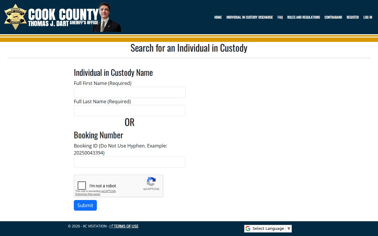
The custody locator uses a full first and last name or a booking ID without a hyphen. A match concerns current county custody information, not a person's relationship to a parcel or surrounding households. It must never be used as permission to approach, threaten, or identify a person to others.
Pleasant Hill Neighbor Voter Records Stay Restricted
California does not offer an ordinary public voter-by-street or voter-by-block browse. The state voter-status form asks for first name, last name, date of birth, and a California driver-license or ID number or Social Security number last four, with “I do not have” options. It returns status, party or language preference, mail or provisional status, polling place, upcoming elections, county contact, and guide preference to the person making the check.
The full voter file is limited under Elections Code section 2194 and Government Code section 7924.000 to approved election, political, scholarly, journalistic, or governmental purposes. Personal, private, and commercial use is barred. Safe at Home participants and specified public-safety confidential voters are excluded. Participation history means the election in which a voter participated, never how that person voted.
A certified file recipient may perform address or precinct analysis only within the approved purpose. That is different from a casual neighbor lookup. For a civic boundary question, use the Pleasant Hill city district address search and adopted five-district map. It identifies the council district and representative, not the people on the block.
The voter-status form is the personal verification route that belongs beside, not inside, a block parcel workflow. It does not open a list of people by address.
Pleasant Hill Neighbors and Watch Groups
Pleasant Hill's official Neighborhood Watch layer is deliberately coordinator-based. The city directs questions to nwatch@pleasanthillpd.org and invites residents to ask whether a group exists or how to organize a meeting. An officer can discuss area crime statistics and prevention. The contact route protects members instead of exposing a list of names and addresses.
| Community source | Documented contact or method | What it can answer |
|---|---|---|
| Neighborhood Watch | nwatch@pleasanthillpd.org | Whether a group exists, how to organize, and prevention contact |
| City district map | Official address-to-district lookup | One address's council district and representative |
| HOA or subdivision | Recorded CC&Rs, property documents, or disclosed manager | Association connection and public rules, not member names |
A civic contact can help someone learn how a block organizes without confirming private household details. The Pleasant Hill district address lookup and five-district map can answer the separate question of which council district covers one address. It also keeps a safety question with the public agency that handles prevention rather than treating a person-search result as an invitation to make contact.
Note: Neighborhood Watch offers a coordinator route so civic contact does not require a public roster.
Pleasant Hill HOA Neighbor Clues
To identify a possible homeowners association, start with the Recorder's recorded CC&Rs, subdivision maps, and related documents. Then compare the association name or agent with California Secretary of State bizfile Online. Those records can show an entity, status, formation date, agent, service address, and filed officer or manager details. They do not establish that a named agent lives in the subdivision or that an owner is an association member.
Association rules can explain shared roads, common areas, parking, or architectural review. They do not make the association a public residents directory. Current rosters, dues records, emails, unit contacts, and internal complaints should be obtained only through the association's own disclosed channel and only for a lawful reason.
For a historical block question, recorded maps and deeds are more durable than a current association page. A subdivision may have changed names, parcels may have split or merged, and Pleasant Hill's pre-1961 records may use an unincorporated county or neighboring locality description.
Pleasant Hill Records Add Block Context
City records can explain what happened at an address without naming every person nearby. Pleasant Hill's permit service supports electronic applications, plan uploads, fees, inspections, and scheduling. New users register, and the city moved to a new permit and business-license system in 2024. Online public-history fields were not fully exposed in the research, so a request may be needed for older or specific permit details.
The Pleasant Hill permits and handouts page is the source for the address-keyed permit gateway shown below.
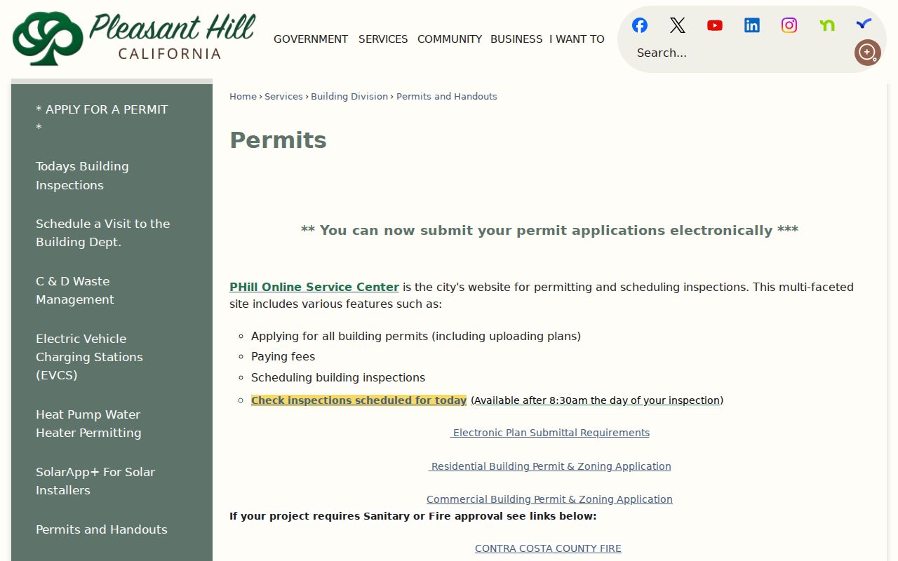
A permit can supply a construction date, applicant, contractor, project scope, or inspection clue. It does not prove that an applicant lived at the parcel or that nearby households share the project.
The Pleasant Hill Code Enforcement page documents an address-based complaint route and the privacy limits around the caller.
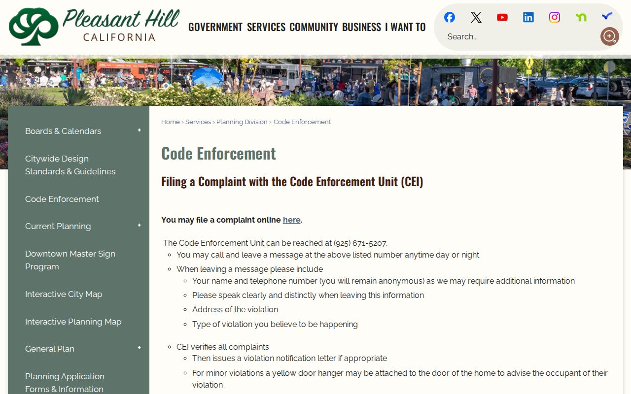
A complaint supplies a violation address and alleged type. Staff may verify the condition and issue a notice, while the complainant remains anonymous unless subpoenaed. It is a request route, not an open person index.
The Pleasant Hill business-license page is another local context source for a public business or service address.
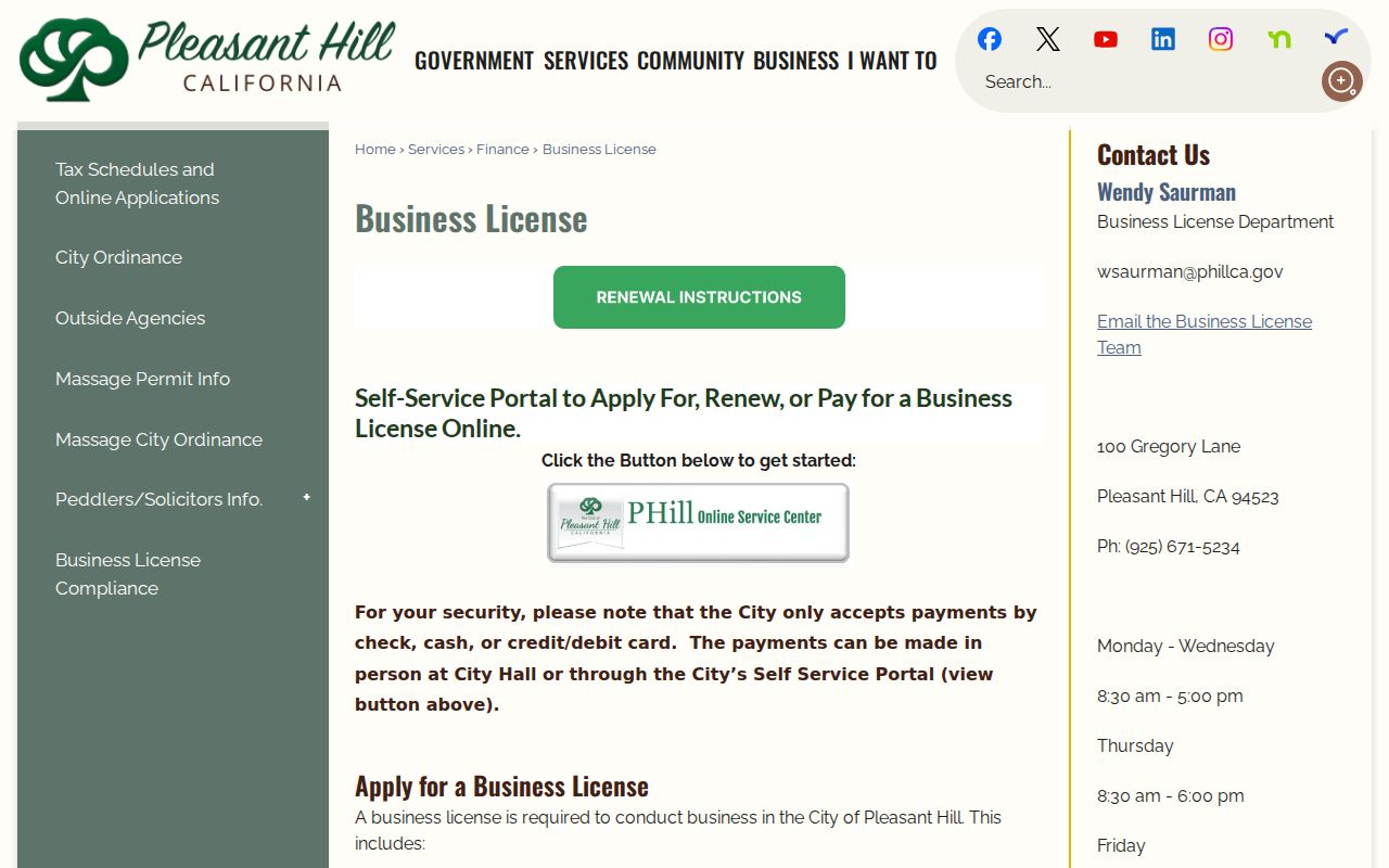
The business-license capture adds public place context rather than household names. Pleasant Hill's license system can connect a business or service activity to a local address, but it does not publish a household directory.
The local license system requires businesses operating in Pleasant Hill to meet city requirements, including firms based outside the city that operate there. It can help connect a public entity to a place, but an existing license register should be requested from Finance or the Clerk because the application portal is not advertised as a public household browse.
Note: A permit or code notice describes an address event, not every household in the surrounding block.
Pleasant Hill Official and Commercial Neighbor Tools
Official sources and commercial neighbor tools serve different purposes. An official record has a named custodian, a defined field, and a stated access rule. A commercial product may merge public and purchased feeds, reuse old addresses, or join two people with the same name. It can be a lead at most, and it cannot override the custodian's current record or a privacy restriction.
| Source type | What it can show | What it cannot establish |
|---|---|---|
| CCMAP and assessment route | Parcel shape, APN, owner or mailing clue through the lawful counter route | Current occupants, unit rosters, or a block-wide resident list |
| Recorder and city records | Deed parties, CC&Rs, permits, code matters, and public business context | That a named party lives at the address today |
| Neighborhood Watch or HOA contact | Group existence, public coordinator, rules, or association connection | Private member names, unit contacts, or household relationships |
| Commercial neighbor tool | A compiled lead that may combine public and commercial data | Custodian-level accuracy, current occupancy, or permission to contact anyone |
For a Pleasant Hill block, the official chain is slower but clearer: address to parcel, parcel to lawful owner clue, document to date, and community contact to public group information. The source should be named in the notes so a later reader can tell what was actually shown.
Pleasant Hill Neighbor Lookup Limits
Some people are absent from public results because the law requires protection. Safe at Home provides eligible participants with a substitute mailing address and confidential voter registration. California's privacy guidance and the 2026 DROP process can help a person request access, deletion, or opt-out treatment from covered businesses and registered data brokers, but they do not erase lawful government originals. DMV information, utility customer lists, delivery data, and private association rosters are not public block sources.
A resident may also appear under an old address, a trust, a business, an unincorporated locality, or a different postal city. That uncertainty is a reason to verify the record type and date, not a reason to seek more private data. If a record is wrong, contact the Assessor, Recorder, city custodian, court, or other source office that created it. For a personal-safety question, use the Sheriff's inmate-information page, CDCR locator, or Megan's Law site for its stated official purpose rather than infer a neighbor from a parcel.
Lawful use. Pleasant Hill block research is for personal safety awareness, family history, civic understanding, and ordinary community contact. Using public information to watch, follow, threaten, harass, or intimidate anyone can violate California law. Do not publish protected addresses or turn a parcel relationship into a claim about a private household.