
Follow a Pleasant Hill Address Trail
Start with the address, not a guessed name. A Pleasant Hill street directory workflow is strongest when each step leaves a stable key for the next one. Normalize the direction, street suffix, unit, and any older form of the address. Confirm city jurisdiction with the city district lookup or CCMAP because postal Pleasant Hill can reach Concord-addressed or unincorporated edges. The chain is address to APN to map parcel to assessment roll to deed parties, followed by a lawful check of voter access and historic reverse directories. An owner is not the same as an occupant. Each source answers a different question.
- Run the complete address through Contra Costa ParcelQuest Lite. If a vacant parcel or a new address does not match, try the APN and record the parcel facts, assessed value, lot details, and map reference.
- Open CCMAP, select the parcel, and pan along the street. Note adjacent polygons, APNs, the assessor map, aerial view, contours, and any radius selection that helps define the block.
- Use the Assessor counter or its request channel for the assessment roll. The online property tools suppress owner names, so record the owner and mailing address from the roll rather than treating a blank web field as unknown ownership.
- Search the current owner as grantee in the Recorder index. Save the recording date, document number, parties, APN, book or page reference, and legal description before searching the seller as an earlier grantee.
- Check Pleasant Hill permit and code records by address. Applicants, contractors, project scope, notices, and dates can add context, but a request may be needed for older or redacted material.
- Use the California voter-status tool only for the voter’s own verification. An approved voter-file recipient may perform a certified address analysis, but the public web form is not a street roll.
- Finish with reverse or criss-cross directories, newspapers, and census schedules. Those sources can show past occupants and neighborhood links that a deed cannot establish.
Pleasant Hill Address Records Begin Here
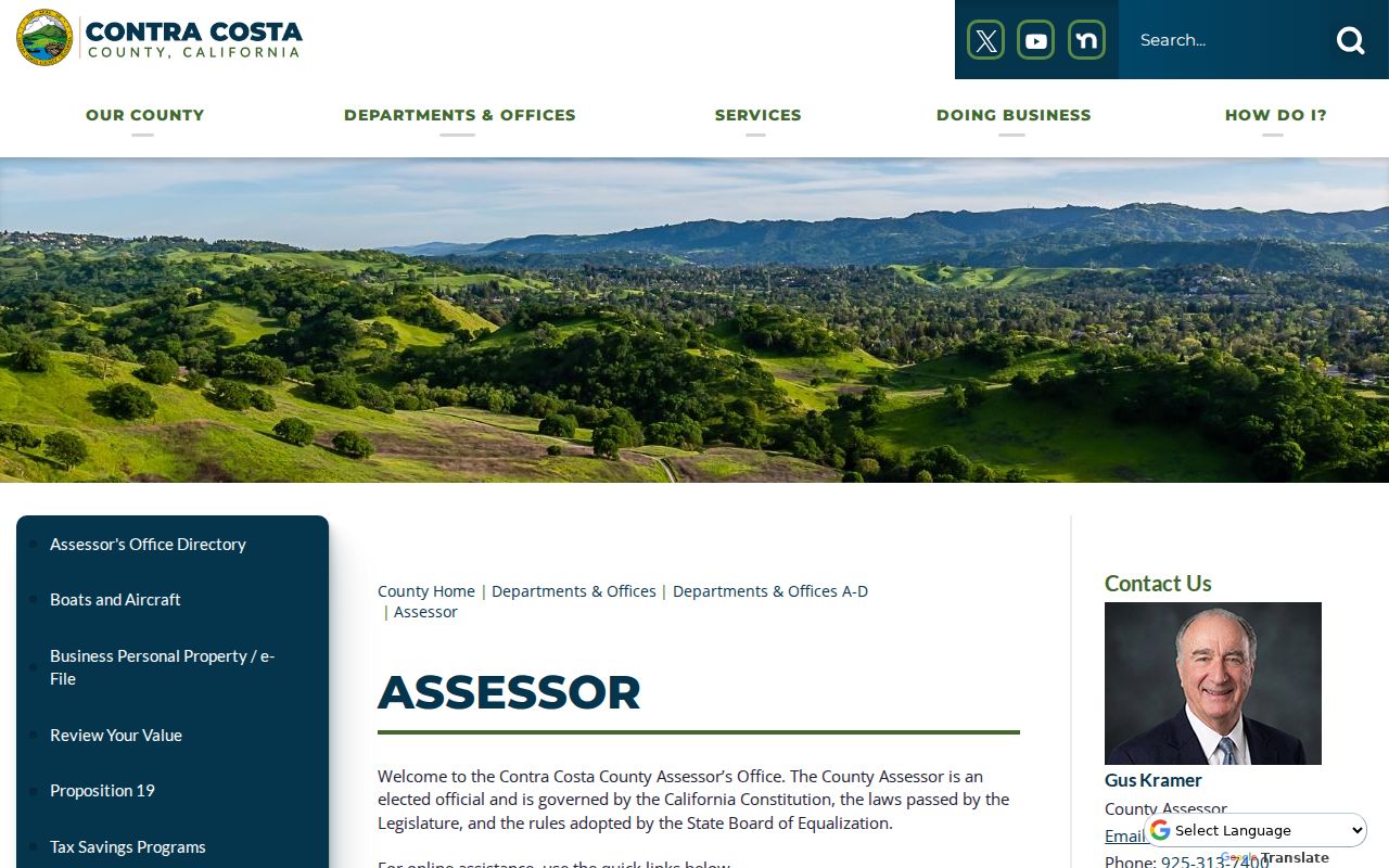
Contra Costa’s Assessor property-information page identifies ParcelQuest Lite and the related map tools. The Assessor office page is the separate contact route for assessment-roll questions. The public search begins with either the street address or the APN. A complete address is useful for a situs search, while an APN is the better bridge for a vacant lot, an old subdivision reference, or a parcel whose street number changed. Save the search spelling and the returned map reference before moving to another record system.
The screen supplies physical and tax context, not a public owner-name directory. Advertised data include APN and map information, assessed value, building details, square footage, lot size, and parcel geometry. A parcel with no address may still be found by APN. The map is reference material, not a survey, and assessed value is not current market value.
That distinction changes the next move: use the web page to identify the parcel, then use the assessment roll or a deed to identify a named property interest.
| Tool or field | Type | Required | Notes |
|---|---|---|---|
| ParcelQuest APN | Text | Either | Needed for vacant or unaddressed parcels |
| ParcelQuest street address | Text | Either | Search the situs address; normalize direction and unit |
| CCMAP address or APN | Text or autocomplete | No | Zooms to or selects a parcel |
| Map click or select | Map action | No | Opens parcel facts and nearby geometry |
| Radius search | Distance map tool | No | County advertises radius selection for nearby parcels |
| Layers | Checklist | No | Parcels, aerials, contours, and available thematic layers |
| Assessor map download | Link or PDF | No | Tax map reference, not a boundary survey |
Online access is free. Counter work fills the name gap. Published Assessor charges include $3 for map pages plus $2.50 mailing, $50 for a radius search, $1 per page for property-information printouts, and $7.50 per parcel for property characteristics.
Note: The web map can establish parcel geography, but only the lawful assessment-roll or recorded-document route supplies a named property interest.
CCMAP Shows Pleasant Hill Street Parcels
CCMAP is the street-browse layer in the Pleasant Hill street directory process. Search the address or APN, click the subject parcel, and then inspect the polygons that touch it. Aerials can clarify a long lot or a shared drive. Contours and parcel lines help explain why a street number does not neatly match a visible structure. Radius selection is useful when the question is the immediate area rather than one parcel.
CCMAP does not place owner names beside the parcel. Its strength is geography: it helps preserve the APN, map context, nearby parcels, lot size, building square footage, and other characteristics that can be carried into the Assessor counter, the Recorder index, or a city request. Use planning, zoning, flood, or district layers as location clues, never as proof of ownership or occupancy.
- Parcel
- A county-defined piece of land tracked by an APN, even when the street address changes.
- Situs address
- The physical location assigned to the parcel for assessment and mapping, distinct from a tax mailing address.
- Plat
- A recorded subdivision or parcel map that ties lots, blocks, streets, and earlier parcel shapes together.
- Criss-cross directory
- A reverse directory arranged by street and number so an address can lead to a historical occupant or telephone entry.
Pleasant Hill Street Record Coverage
A Pleasant Hill street directory is assembled from several custodians. The records overlap, but they do not answer the same question. Parcel tools place land. The assessment roll names an owner of record when counter access is available. Deeds show recorded parties. City files show work or enforcement at an address. Voter access is the narrowest layer, not a general way to browse a block.
| Record set | Keeper | What it shows | Access |
|---|---|---|---|
| Parcel and map | Assessor and CCMAP | APN, situs, boundaries, lot, building, and value facts | Free web tools; no owner names |
| Assessment roll | Contra Costa Assessor | Owner of record, mailing address, and assessed values | Counter or request channel; protected entries apply |
| Deeds and liens | Clerk-Recorder | Named parties, recording dates, legal descriptions, and liens | Free index, counter research, and paid copies |
| Property taxes | Contra Costa Tax Collector | Bill status and parcel linkage | Parcel or bill lookup and request channels |
| Permits | Pleasant Hill Building Division | Applicant, owner, contractor, scope, inspection, and dates | PHill portal or CPRA request |
| Code cases | Pleasant Hill Code Enforcement | Address, alleged or confirmed violation, and notices | Request route with possible redactions |
| Voter record | California Elections officials | Voter’s own status; approved file fields for certified purposes | Self-lookup or restricted approved access |
The APN is the useful join key. Carry it from ParcelQuest to CCMAP, from the roll to the deed, and from the deed to the legal description. A street name alone is weaker because streets can cross jurisdictions, lots can split, and older records may use a locality label that predates Pleasant Hill.
Note: A parcel identifier is strongest when the map, assessment entry, deed, and legal description all point to the same land.
Pleasant Hill Owner Records Online
Contra Costa’s web policy is a local quirk worth treating as a finding. The county suppresses every owner name in its public internet parcel tools rather than maintaining a web list that would need to identify protected officials and safety personnel. An empty owner field therefore means that the online layer is designed that way. It does not mean the parcel has no owner or that a deed cannot be found.
The public assessment roll remains the counter fallback. Ask for the parcel by APN or situs address, then compare owner name, mailing address, assessed value, and legal description. A mailing address different from the situs can suggest that tax mail goes elsewhere, but it cannot establish who occupies the parcel. The most reliable street directory work states which fact came from the map, which came from the roll, and which came from a recorded instrument.
Pleasant Hill Street Deeds Through Time
The Contra Costa Official Records Index, often called CRiis, is the name trail after the parcel is known. Its live index covers January 1, 1986 to the present, although the latest day may be partial. APN deed searching reaches March 3, 1997 to the present. Search the current owner as a grantee, inspect the acquisition instrument, and then search the seller as a prior grantee. The chain should be checked against APN, subdivision, lot, and legal description when names are common.
CRiis results can show recording date, document number and type, party names and roles, and book, page, or legal references. Search fields include name, document number, book and page, partial-match option, document type, recording dates, map or APN modes, and navigation buttons for index, fiche cell, document display, or clearing a search. The Clerk-Recorder counter is at 555 Escobar Street in Martinez, with telephone number (925) 335-7900. A deed records a transfer or interest. It does not by itself prove that a named party lived at the address.
- Record the grantee, grantor, document type, recording date, and document number.
- Compare the legal description and APN with the parcel map before treating two names as one chain.
- Separate deeds from deeds of trust, reconveyances, liens, and notices that reflect financing or another interest.
- Use the recorder counter, books, or fiche when the web index stops short of the period needed.
Contra Costa’s Recording Notification help page explains an alert service for a selected name, address, or APN. The successful capture below shows that access point. Alerts can flag a newly indexed instrument, while suspected title fraud can be reported to the Contra Costa District Attorney Real Estate Recording Unit at (866) 223-7283.
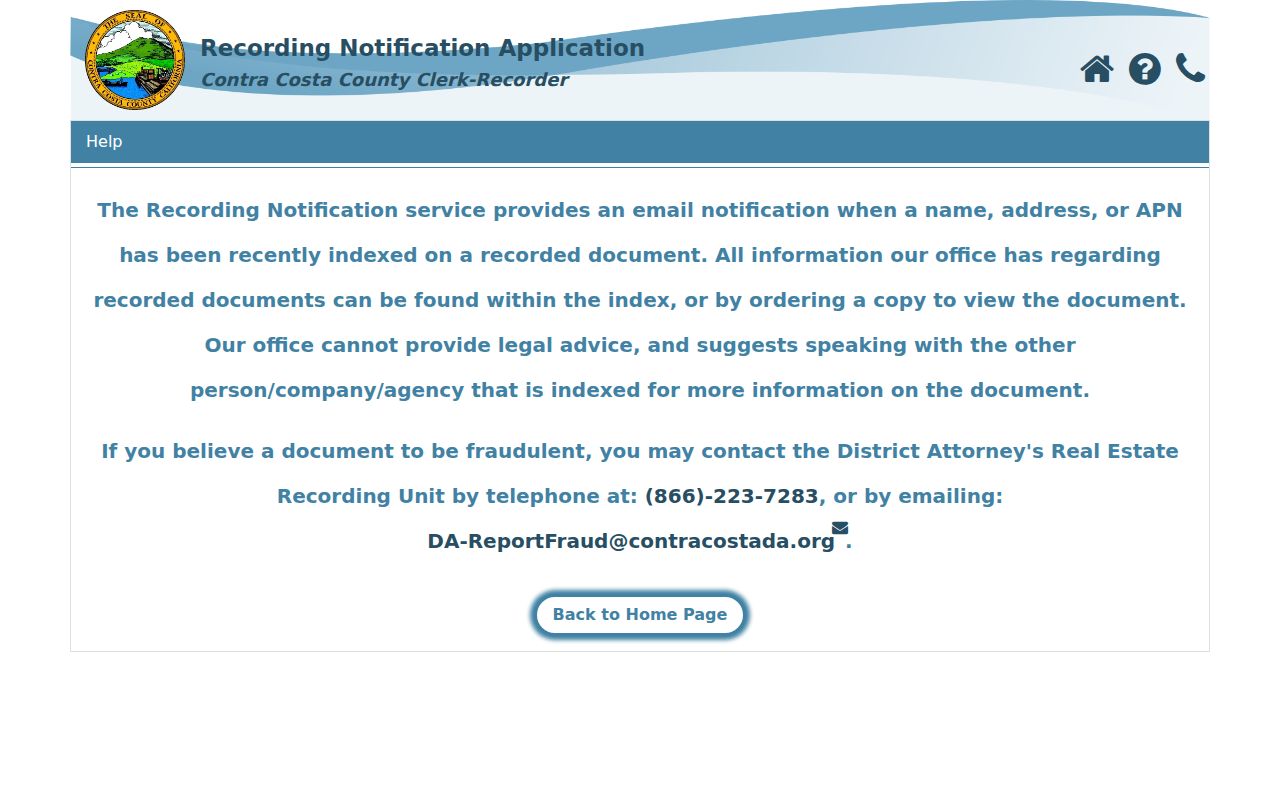
The county has also mailed a bilingual notice and document copy to an original owner after a title transfer since 2011. Treat an alert or notice as a prompt to read the official record, not as a conclusion about a person.
Pleasant Hill Permit Records by Address
Street research gains another time marker from the Pleasant Hill PHill Online Permit Service Center. The city supports electronic applications, plan uploads, fees, inspections, and a same-day inspection schedule after 8:30 a.m. New users register, and login is required to apply or schedule. The city moved to a new permit and business-license system in 2024. A permit can connect an address to an applicant, owner, contractor, project scope, or construction date, but it is not a household roll.
For existing city-created material, start with the Pleasant Hill public-records request entry point. The City Clerk at 100 Gregory Lane keeps official city records and can be reached at (925) 671-5221. Counter hours are Monday through Wednesday 8:30 to 5, Thursday 8:30 to 6, and Friday 8:30 to 1. Describe the permit address, date range, permit number if known, or record type. Anonymous online permit-history fields were not fully exposed in the research, so a request is the documented fallback. Code Enforcement accepts address-based complaints and can supply releasable notices, but caller details and protected law-enforcement information may be withheld or redacted.
- Use a permit address and date span when the project number is unknown.
- Distinguish an applicant or contractor from the owner of record.
- Ask for existing records rather than asking City Hall to create a new list.
- Read code notices as address evidence, with confidentiality limits on the complainant.
Note: A permit applicant and a deed party can differ, so keep construction evidence separate from the title chain.
Pleasant Hill Reverse Directory Clues
A reverse or criss-cross directory changes the direction of the search. Instead of starting with a surname, turn to the street and house number, then read the occupant or telephone entry. An alphabetical directory can show a person’s address, while a reverse section can show who was associated with an address at the time of publication. Inclusion was not universal, and a delayed publication date can lag a move. The printed locality may say Concord, Walnut Creek, or a county suburban section rather than Pleasant Hill.
The verified regional anchor is R. L. Polk and Company’s Richmond and Contra Costa County Directory for 1914 to 1915. Exact Polk, Haines, and telephone directory years for Pleasant Hill are not officially enumerated online. The full shelf and its gaps belong in the Pleasant Hill directory book collections, where local newspapers, microfilm, the History Center, and the census can be paired with each address clue.
- Owner of record
- The person or entity named in the assessment or recorded property chain, not a guaranteed occupant.
- Mailing address
- The place used for tax correspondence, which may differ from the parcel’s physical situs.
- Reverse entry
- A historical address-to-name or address-to-telephone line, subject to the volume’s inclusion rules.
- Address continuity
- The evidence that two old forms of an address describe the same parcel, usually supplied by a plat, APN, or legal description.
Pre-1961 Pleasant Hill Street Records
USPS address lookup validates the mailing city and ZIP. The principal verified city-serving ZIP is 94523. The Pleasant Hill Post Office is at 1945 Contra Costa Boulevard, Pleasant Hill, with telephone number (925) 687-0533; listed retail hours are Monday through Friday 9 to 5 and Saturday 10 to 2, so verify them before travel.
Pleasant Hill was incorporated in 1961. Earlier deeds, census schedules, maps, and directories can therefore use unincorporated Contra Costa, Concord, Walnut Creek, a ranch, or a subdivision label. Residential subdivision grew south of Gregory Lane and west of Contra Costa Boulevard in the 1920s and 1930s, then expanded north of Gregory Lane from 1946 to 1954. Those phases explain why a modern street search may need older locality terms.
No official source located a citywide street renumbering year. When an old number does not match the modern one, compare the legal description, subdivision map, assessor map books, and adjacent parcels. The city’s address-to-council-district lookup is a current jurisdiction check, while CCMAP and the deed map provide the parcel continuity. Pleasant Hill BART is another naming trap because the station is in the Contra Costa Centre and Walnut Creek postal geography.
Note: Older locality labels belong in the research log because Pleasant Hill did not exist as an incorporated city before 1961.
Pleasant Hill Voter Records Have Limits
The California voter-status tool is a personal verification form, not a public Pleasant Hill street directory. It asks for first name, last name, date of birth, and a California driver license or ID number or the last four digits of a Social Security number. Each identifier has an “I do not have” option. A successful self-lookup can return status, location, party or language preference, mail or provisional status, polling place, elections, county contact, and guide preference. It does not reveal ballot choices.
California Elections Code section 2194 limits the full voter file to approved election, political, scholarly, journalistic, or governmental uses. Personal, private, or commercial use and harassment are prohibited. An approved recipient completes the state file application with identity, organization, purpose, and certification details; a general web visitor cannot browse everyone on a street. Safe at Home participants and other confidential voters are suppressed. The voter hotline is (800) 345-VOTE, and Safe at Home participants use (877) 322-5227 for a confidential voter registration card.
California voter-registration guidance explains the restricted file and confidential registration rules. A street directory should never imply that a voter-status result is a complete list of residents.
Pleasant Hill Street Directory Limits
A Pleasant Hill street directory cannot supply every person connected to a parcel. A deed may omit occupants. A reverse directory may omit a household or use an old number. Apartment parcel records can identify a complex owner without listing individual units. Utility customer lists, delivery data, and household-member details are not public block records. DMV address information is protected by the federal Driver’s Privacy Protection Act. A renter may appear in a historical directory, but current occupancy is not established by a map, tax bill, or deed.
Use the parcel and deed chain for property history, directories and newspapers for historical people, and the proper custodian for a public record request. When the goal shifts from a whole street to one known person, the Pleasant Hill resident lookup workflow keeps name matching and verification separate from address browsing.
Lawful use. Pleasant Hill address records are suitable for genealogy, house history, reconnecting with known people, and civic research. Public availability is not permission to stalk, harass, intimidate, or publish a protected address. California Penal Code sections 646.9 and 422 may apply.